Overview
Itinerary
Arrive into Dushanbe today (or very early morning next day) and overnight. Stay: Atlas Hotel (or similar).
We leave the hotel around 10. 30am and start exploring Dushanbe, the capital of Tajikistan. We start with an overview of Tajik history at the National Museum of Antiquities, where we see a reclining Buddha statue. Next, we visit Mehrgon Market where we can try local fruits and learn Tajik bargaining skills. We have lunch (not included) in a cafe within a training centre run by the NGO Chatr, which means umbrella. The centre provides free courses to women who have suffered abuse.
Later in the afternoon, we walk beside the fountains of Rudaki Avenue and visit the Rudaki Monument, dedicated to the founder of Tajik-Persian literature. We also see the Ismail Somoni monument to the first emir of the Tajik nation.
Next stop is the Gurminj Musuem of Pamiri Musical Instruments. We end the day with the choice of a cooking class or pottery demonstration. The cooking class sees us learn about plov, the rice and meat-based national dish. Stay: Atlas Hotel (or similar) (B/D).
We drive south from Dushanbe passing through hilly landscapes and pastures to reach Norak Dam. We continue to Hulbuk Fortress and museum in Vose to learn more about the regional history.
Following a stop for lunch (not included) in the city of Kulob, we visit the mausoleum of Mir Said Ali Hamadani, a poet from Iran who preached Islam in Central Asia. Our drive continues over the Shurobod Pass to Anjirob, where we stay overnight with a local family. We cover around 150mi (240km) today on good roads, which takes about six hours with stops, with a maximum altitude of 2890 ft/880m. Daytime temperatures can be very high today. Stay: Homestay (B/D).
Following a very early start, we drive to into the hills to view markhor goats, the largest member of the goat family, best known for their twisting horns. This animal-watching adventure can take about three hours including the driving. We do this very early while temperatures are cooler as chances of seeing the goats are better before the heat of the day sends them to shelter behind cool rocks.
This can mean leaving our homestay at approximately 4 am (it is possible to remain at the homestay if you prefer). The goats are usually seen through binoculars or a telescope. As we continue our journey, the road squeezes through the gorge of the Panj River into the western Pamirs. The Panj forms the border with Afghanistan, which we follow for the next few days, allowing us to peer into Afghanistan along the way.
On arrival in Kalai Khumb (altitude 1,270m), we walk in town or visit the Karon archaeological site, which is thought to be the last-surviving Zoroastrian water temple in Central Asia and has only been excavated relatively recently. There are fantastic mountain views from the site. There are about three hours of driving today (75mi/120km) mostly on good roads, with a maximum altitude of 1,270m. Stay: Guesthouse (B/L/D).
If we didn't visit Karon yesterday, we do so this morning. We continue our drive along the Panj River, tracing the border, stopping for a box lunch along the way. Early afternoon, we reach Khorog, the capital of the mountainous Badakhshan region. At an altitude of around 6,800ft (2,100m), it sits in a narrow valley where the Shakhdara and Ghund rivers flow into the Panj. While small, the town is an important cultural centre with two universities and a theatre. We explore Khorog, walking through Chorbogh park. We drive for around seven hours (160mi/260km) today including stops, mostly on a poor road which is undergoing construction work in places which can sometimes delay our journey. Maximum altitude of 6,840ft (2,085m). Stay: Lal Inn (or similar) (B/L).
This morning, we visit Khorog bazaar. Here, we can purchase traditional goods, including juraby (woollen socks) and toki (colourful embroidered skullcaps). We also visit Khorog botanical gardens, high above the city. From Khorog, the Pamir Highway heads east. However, we'll head south, continuing along the Panj River and the Afghan border. We stop at Garm Chashma, a small town home to sacred, sulphurous hot springs. Impressive white-yellow deposits are formed where the water flows out of the earth and cools.
We continue to Ishkashim, where the valley widens and the waters of the Panj calm. This is the start of the Wakhan Valley, a legendary area in the Silk Road age. Always remaining in Tajikistan, we follow a route along the edge of the Wakhan Corridor, which once acted as a buffer between the Russian and British empires during the Great Game. This sliver of Afghanistan separates Tajikistan from Pakistan to the south. To the east lies the Xinjiang province of China. The Wakhan is home to mountain fortresses and numerous other intriguing sites. To the north are the Pamirs, to the south are the mountains of the Hindu Kush and Karakoram. We have a picnic lunch in Namadgut and visit Qah-Qaha fortress and Shohi Mardon shrine. We have views to Karl Marx Peak (22,057ft/6,723m) and Engels Peak (21,348ft/6,507m).
In the evening, we reach Yamg and spend the night in a chid, a traditional Pamiri home.
Following dinner, we have a demonstration of local Pamiri dances. We drive for around six hours today (155mi/250km) including stops, with a maximum altitude of 2,750m. The condition of the road today is generally reasonable. Stay: Homestay (B/L/D).
We start the day with a visit to the lovingly decorated Muborakkadam Wakhoni musuem. Wakhoni was a Sufi educator, astronomer and musician. We see a stone solar calendar in Yamg. Next, we drive back to Yamchun to visit an impressive mountain fortress giving us views across the Wakhan and its fertile gardens, fields and villages.
We visit the thermal baths of Bibi Fatima and marvel at a Buddhist stupa in Vrang, plus observe numerous cliff caves once inhabited by Buddhist monks. In Zong, we can climb the imposing ruins of Abreshim Qala fortress and gain views of the Pamir and Wakhan rivers merging to form the Panj, which we've followed over much of the previous days. We spend the night in Langar. We drive for around four hours today with stops, covering around 40mi (70km) with a maximum altitude of 2,880m. Road conditions today are generally reasonable. Stay: Homestay (B/L/D).
We visit Langar parish hall and an old shrine decorated with ibex and Marco Polo sheep antlers. A walk across flat granite slabs above the village takes us to an area of nearly 6,000 petroglyphs dating from the Bronze Age to the present. A detour takes us to the ruins of Ratm Castle. Heading along the Pamir River, we see a caravanserai on the other side and may see Bactrian camels. We pause at a military checkpoint then head towards Zorkul Lake (once known to the British as Lake Victoria), the landscape changes and the eastern Pamir plateau comes into view in front of us.
The plateau has an average altitude of 13,000ft (4,000m) and the inhabitants call it Bam-i Dunya, the roof of the world. Leaving the (relatively speaking) main road behind us, we head to Jarty Gumbez, known for being home to hot springs, a sun calendar and the tombs of Scythian and Kyrgyz nomads. We may come across herds of Marco Polo sheep, which are giant, wild sheep with horns up to 5ft (160 cm) long. We have time to refresh in the hot springs. We travel for about six hours today, covering 80mi (130km), reaching our highest sleeping altitude of the trip at 4,110m. We travel off main roads today along rough and bumpy tracks which can be muddy. Stay: Guesthouse (B/L/D).
We have an early start and head off with a ranger in search of Marco Polo sheep herds. It may take us a few hours to find them. The sheep are usually seen through binoculars or a telescope. If we're lucky, we might see ibex too. After returning to the guesthouse, we visit Scythian burial grounds. We now head north, crossing the Ak-Bura Pass at 13,780ft (4,200m). We enter the lunar landscape of Shorbuloq, which has colourful rock formations and a cave with Bronze Age rock paintings at Shakhti. We pass Shorbuloq observatory, once an important Soviet observatory, located here due to the regular dry, cool and stable climate. In clear weather, we can see mountains in China: Muztag-Ata (24,757ft/7,546m) and Kongur (25,325ft/7,719m).
In the late afternoon, we meet the Pamir Highway once again and head to Murghab, the administrative centre of the eastern Pamirs. Murghab was an important military station in the 19th century under the Tsars and later for Soviet Russia. Now the inhabitants are mostly Kyrgyz. There is a small bazaar, mosques and a cemetery, which are worth seeing. We have about four hours of travel today (80mi/130km), excluding looking for Marco Polo sheep. Our maximum altitude today is 11,875ft (3,620m). The first part of the day is on rough tracks. As we approach Murghab, we rejoin the Pamir Highway and the road conditions improve. Stay: Homestay (B/L/D).
We have a short tour around Murghab, seeing the market and yak house where we can purchase yak-wool handicrafts. Yurts were common in pre-Soviet times, but following construction of permanent houses they are less common. On our way to Karakul Lake, we reach the highest point of the Pamir Highway and our adventure: Akbaital Pass at 15,272ft (4,655m).
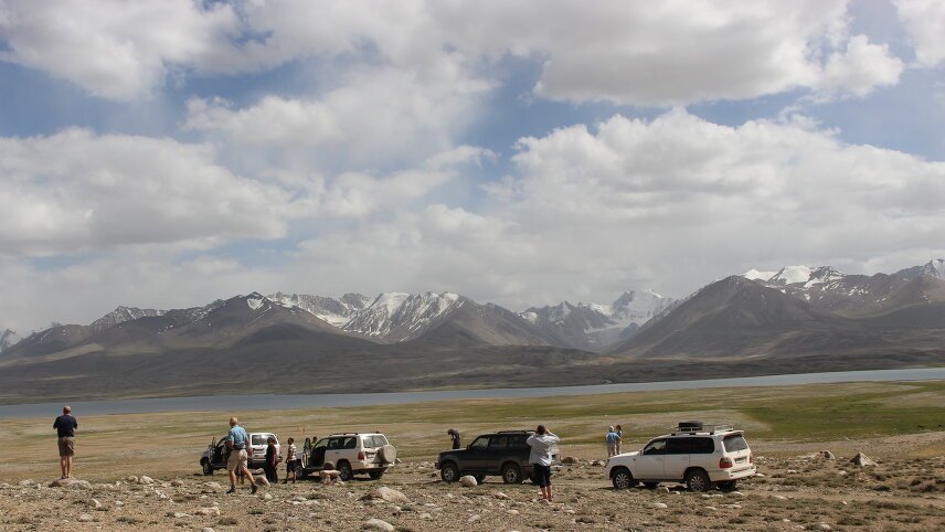
We spend the night in Karakul (meaning Black Lake) at 12,800ft (3,900m) above sea level. The lake itself is 15mi (25km) wide and sits within a crater formed by a meteor impact millions of years ago. This is a cold, remote and hard place to live. We cover around 85mi (135km) today, taking about three hours, reaching the second highest altitude point in this trip of 13,000ft/3,950m. The road is reasonably good today. Stay: Homestay (B/L/D).
We leave Karakul and the Pamir Highway and head southwest into the Bartang Valley. The road is particular rough and travel is very slow but we're rewarded with a route few tourists take and spectacular mountain scenery. The name Bartang translates approximately as ‘narrow passage' which is very apt. We stop at Shurali geoglyph and have a picnic lunch along the way. We stay the night in Ghudara village, partway along the valley. We drive for about five or six hours today with stops on the way, covering around 77mi (125km). Today's maximum altitude is 3,010m. The road is rough. Stay: Homestay (B/L/D).
We continue slowly making our way through the Bartang Valley, enjoying the landscapes along the way. We stop at Savnob village to see a 19th-century castle and hear its legends. Inhabitants of the Bartang are among the most hospitable people in the Pamirs. We stay the next two nights in a chid in the village of Yemts with a carved-wood ceiling and square roof window. The interior of chids have symbols linked to the Ismaili faith. We travel for about six hours today (85mi/135km), with a maximum altitude of 2,060m. The road is rough. Stay: Homestay (B/L/D).
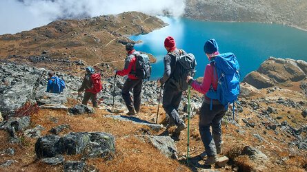
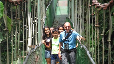
We hike in one of the side valleys of Bartang today. You may remain in Yemts on your own if you don't wish to do the hike. We start by crossing a long bridge over a river and can see tiny terraces, small orchards and fields. Barberry and buckthorn bushes line the narrow path that villagers from Jizew use to reach Bartang.
The river is dammed by landslips in places forming small lakes. We have a picnic lunch along the way. Ascent: 1,640ft (500m) ; descent: 1,640ft (500m) ; walking distance: 8. 5mi (14km) ; walking time: approximately six hours, with a maximum altitude of 2,060m. The road is rough. Stay: Homestay (B/L/D).
We visit an old mazar this morning, a shrine where Zoroastrianism and Ismailism mix. Shortly after leaving Yemts, we exit the Bartang and are back on the Pamir Highway and return to Kalai Khumb. Along the way, we pass white-sand dunes by the river. On the Afghan side, we see the network of tiny paths across steep rock walls, which used to be the only connections between villages. We stop for lunch (not included) and may have the chance to try local honey.
On arrival in Kalai Khumb, we have a welcome night in a hotel for the first time in several days. We cover around 150mi (240km) today over about eight hours (including stops), with a maximum altitude of 1,270m. The road is poor today. Stay: Karon hotel (or similar) (B).
This morning, we return to Dushanbe over the Saghir Dasht Pass (10,670ft/3,252m), a different route to the one we took on our outward journey. As we leave the high mountains of the Pamirs behind, the view changes completely. We have a break in Tavildara, where we can see the colourful rocks of Navruz Mountain. We pass orchards and villages and the landscape is increasingly green as we travel through the wide valleys of Vakhsh and Obikhingou. There are about eight hours of travel today, covering 210mi (340km). Stay: Atlas Hotel (or similar) (B/L).
The trip ends today in Dushanbe. We begin our return journey home. Alternatively, if you'd like to explore a little more, speak to your sales representative about extending your stay (B).
Trip Inclusions
- Drive along the spectacular Pamir Highway
- Enjoy views to the Hindu Kush and Karakorum mountains
- Peer across the Panj river into Afghanistan
- Trace the lines of the Wakhan Corridor, a region associated with the Great Game
- Visit archaeological sites and remnants of the Silk Road
- Search for Marco Polo sheep and markhor goats
- Take a day walk between remote villages in Bartang
- 4 Classic nights (hotels), 12 Simple nights (7 homestays, 2 guesthouse, 2 hotel)
- Single supplement available only in Dushanbe, Khorog and Kalai Khumb (Karon Hotel only)
- An adventurous trip through a spectacular and little-visited region, with limited comfort
- Most travel is by 4×4 along often-rough roads. Maximum three passengers per vehicle
- All transport and listed activities
- 14 breakfasts, 11 dinners and 11 lunches (mostly box or picnic lunches)
- Itinerary and inclusions are subject to change
- Price is for land, cruise and internal flights as specified. Flights not specified are not included

From classic small group tours & family adventures, to walking holidays, cycling trips and self-guided tours. Read more

Exodus chooses their Leaders carefully. Professional, dedicated and are passionate about sharing their home countries. Read more

Wherever possible, Exodus chooses properties that are locally owned and that reflect the area you are visiting. Read more
Availability
A definite departure means minimum numbers have been reached for this departure to operate. Your Global Journeys Travel Advisor will check the availability of your departure date when you enquire. Additional savings may apply. We guarantee the lowest price in Australia. T&C’s apply.
Tour & cruises prices are per person. Prices shown have savings applied, are subject to availability and may be withdrawn at any time without notice. Pricing and trip details are correct at this point in time, however are subject to confirmation at the time of booking and are subject to change by Exodus. For cruise itineraries, cabin images are sourced from Exodus. These should be treated as indicative only. Cabin inclusions, upholsteries and room layout may differ to the image(s) shown depending on the ship selected and your sailing dates.


