Overview
Itinerary
The trip starts at Inverness Rail Station at 13.30. After meeting we have a scenic drive (1.5hrs) to Ullapool, a thriving fishing town nestled on the shores of beautiful Loch Broom. Founded in 1788 as a herring port, the town was designed by Thomas Telford. Despite its size with just 1500 inhabitants, it is the largest settlement in the area and an important tourist destination and port. Located just to the north of Ullapool is the UNESCO Geopark of the North West Highlands - an area of remarkable natural beauty, with dramatic mountain landscapes, pristine sandy beaches, ancient settlements and remote communities - all within one of the most sparsely populated corners of Europe. After settling into our accommodation we plan a warm up hike on Ullapool Hill with commanding views over the loch, village and the Summer Isles - a perfect introduction to our trip.
The Tour Leader will talk through the plan for the coming days in an introductory briefing this evening. Please note that the planned walks may need to be changed in accordance with the weather, to maximise your enjoyment, and the Tour Leader will discuss these on the ground if necessary.
Today's intro walk will take approximately 2 hours and will cover a distance of 3-4 kilometres/1.9-2.5 miles along grassy trails with a total ascent and descent of 500 metres/1,641 feet. Stay: The Sheiling B&B (Comfortable) (D)
After a full Scottish breakfast we embark on our first exploration of the UNESCO Geopark with a wonderful walk in the Assynt region just to the north of Ullapool. Assynt is rich in indigenous plant life such as lavender, miniature wild orchids and Scotland's national flower, the thistle. The western part of this area has distinctive-shaped mountains sculpted by the huge forces of glaciation, resulting in 800 million-year-old Torridonian sandstone 'island' mountains that rise majestically from the loch-strewn moors. Our aim today is to climb Cul Mor and the ascent starts from Knochan Crag making use of a good path onto the upper reaches of the hill with some off-trail hiking towards the top. From the summit we enjoy a breath-taking 360' panorama of this dramatic landscape. We descend and return to the vehicle via a different route.
Today's walk will take approximately 6 hours and will cover a distance of 14 kilometres/8.7 miles, with a mix of trails and off-trail routes, with a total ascent and descent of 750 metres/2,461 feet. Stay: The Sheiling B&B (Comfortable) (B)
We check out of the guesthouse this morning after breakfast. First we drive north again into the Geopark, this time further east into the Inverpolly area to Stac Pollaidh; arguably one of the more well-known and distinctive hills in the area. From the foot of the mountain with its distinctive sandstone pinnacles shaped by the last ice-age, it looks impressive, but the climb is relatively easy. After hiking to the easterly top and taking in the unforgettable vista, we continue our walk all around this mountain on the way back down. Back in the vehicle we make our way, on a scenic drive south (2hrs), to our next base in Gairloch. If time permits we have a quick stop at Corrieshalloch Gorge, an impressive 200meters/656 feet deep chasm containing the Falls of Measach. Situated on the shore of Loch Gairloch, the small town of Gairloch is a great base for exploring the awe-inspiring scenery of Wester Ross.
Today's shorter walk will take approximately 3 hours and will cover a distance of 4 kilometres/2.5 miles, mostly on trails, very steep in parts, with a total ascent and descent of 510 metres/1,673 feet. Stay: Myrtle Bank Hotel (Comfortable) (B)
Today we explore the dramatic coastal scenery on the headland just to the north of Gairloch, with stunning views across the Straits of Minch to the Isle of Skye and the Western Isles. We ascend from sea level to the 350-metre cliffs, looking out for marine life such as Atlantic seal, dolphin or basking shark, and abundant birdlife including gannets, fulmar, shag, kittiwakes and divers. Unique heathland plants thrive here, including bog asphodel and several species of insectivorous plants. The coastline offers many miles of beautiful cliffs, sea stacks and sandy beaches. After the walk we return to Gairloch and the rest of the afternoon is free. We suggest a visit to the fascinating Gairloch Museum and or the famous Inverewe Gardens by Osgood Mackenzie. The gardens are noted for their Himalayan and New Zealand plant collections, as well as their classic English garden.
Today's walk will take approximately 4-5 hours and will cover a distance of 11 kilometres/6.9 miles, mostly off trail and undulating, with a total ascent and descent of 280 metres/919 feet. Stay: Myrtle Bank Hotel (Comfortable) (B)
After breakfast and checking out of our accommodation we drive east and our first stop is the Beinn Eighe massif, Britain's oldest National Nature Reserve - which now forms part of the UNESCO Wester Ross Biosphere reserve. Beinn Eighe is a vast mountain ridge, between Glen Torridon and Loch Maree, with a cluster of rugged peaks and screes slopes that are home to a diversity of wildlife. The lower hillsides are home to 350-year-old Scots pines and the oldest rocks here (indeed the oldest in the world) are Lewissian gneiss, dating back some 3 billion years. Our walk climbs steeply from pinewood forest onto a bare plateau of quartzite rocks. The views over Loch Maree and the hills behind are breath-taking.
In the afternoon we continue our drive through beautiful scenery, stopping after an hour to visit the 13th century Eilean Donan Castle - one of the most spectacular in Scotland. We then drive across the bridge to Skye, the largest and northernmost of the Inner Hebrides, and on to our final base in the tiny hamlet of Sconser located on the shores of a sea loch.
Today's shorter walk will take approximately 3-4 hours and will cover a distance of 7 kilometres/4.4 miles, mostly on marked trails, with a total ascent and descent of 680 metres/2,231 feet. Stay: Sconser Lodge (Comfortable) (B)
After breakfast we drive a short distance into the Cuillin Hills. 2 Cuillin ranges dominate the landscape on Skye - the Black and the Red Cuillin separated by Glen Sligachan. The iconic ridge of the Black Cuillin is one of the most challenging ranges in the UK and is often the training ground for British climbers preparing for Himalayan ascents. The Munro Bruach na Frithe is considered one of the more accessible and straight forward peaks in this beautiful range and the views get better with each step on the rocky path. Once on the top, the amazing views include Ben Nevis to the east and the Outer Hebrides to the west.
Today's walk will take approximately 6-7 hours and will cover a distance of 14 kilometres/8.7 miles, on rocky trails, with some scree and some off-trail sections, with a total ascent and descent of 950 metres/3,117 feet. Stay: Sconser Lodge (Comfortable) (B)
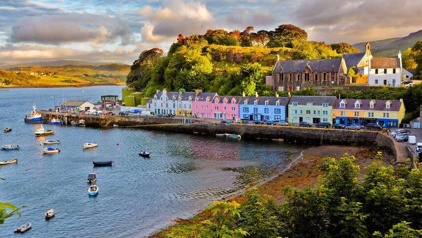
For our final day of hiking we enjoy a scenic drive (1hr) up to the far north end of the Trotternish Ridge to the Quiraing - a stunning landscape that has been formed by a massive landslip which has created rugged cliffs, hidden plateaux and rock pinnacles. Our goal is The Table - a grassy summit plateau that offers dramatic views of the surrounding landscape including the Cuillin, the Western Isles, the mountains of Wester Ross and out to the sea. Time permitting, we plan to make a stop in charming and colourful Portree, the capital of Skye, on the way back to our accommodation.
Today's shorter walk will take approximately 4-5 hours and will cover a distance of 7 kilometres/4.3 miles, sometimes on-trail and other times off-trail, grassy with some rocky sections, with a total ascent and descent of 380 metres/1,247 feet. Stay: Sconser Lodge (Comfortable) (B/D)
After a last hearty breakfast we bid farewell to the Isle of Skye. The drive back to Inverness takes around 3 hours and we plan to drive alongside Loch Ness for the final section of the route. We arrive back at the rail station at about 12.30 where the trip ends. (B)
Trip Inclusions
- Climb iconic hills in the North West Highlands Geopark
- Explore the Wester Ross coastline with stunning seascapes and pristine beaches
- Experience the magic of the Cuillin and Quiraing on the Isle of Skye
- For those who are fit and active, these moderate walks are normally on good paths and tracks at low altitude. Days may include some fairly demanding ascents and descents, so previous experience is preferable but not essential.
- Accommodation, itinerary and inclusions subject to change.
- Price is for land, cruise and internal flights as specified. Flights not specified are not included
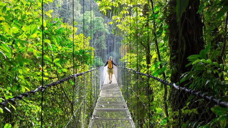
Launching in 1981, Explore offer trips from over 130 countries - from classic small group tours. Read more

Explore's leaders are more than just your typical guide. They're your local expert are are passionate about sharing their expertise with you. Read more
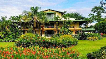
The places Explore stay are every bit as important as the sights they visit and the things you do. Read more
Brochure

Explore Small Group Adventures (2024-25)
Availability
A definite departure means minimum numbers have been reached for this departure to operate. Your Global Journeys Travel Advisor will check the availability of your departure date when you enquire. Additional savings may apply. We guarantee the lowest price in Australia. T&C’s apply.
Tour & cruises prices are per person. Prices shown have savings applied, are subject to availability and may be withdrawn at any time without notice. Pricing and trip details are correct at this point in time, however are subject to confirmation at the time of booking and are subject to change by Explore. For cruise itineraries, cabin images are sourced from Explore. These should be treated as indicative only. Cabin inclusions, upholsteries and room layout may differ to the image(s) shown depending on the ship selected and your sailing dates.
Similar Tours
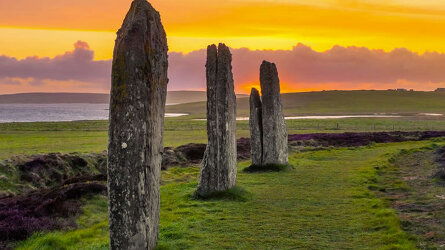
7 Days Inverness Inverness
Operated By: Explore
